Onshore
Seekable’s technology ensures reliable and precise detection of buried cables on land. Whether intertidal areas, mudflats, or grassy fields, our solutions are designed to tackle the challenges of hard-to-reach or complex environments. Land-based monitoring and surveys help utility owners and cable companies verify installation quality, track cable positions, and protect critial infrastructure over time.
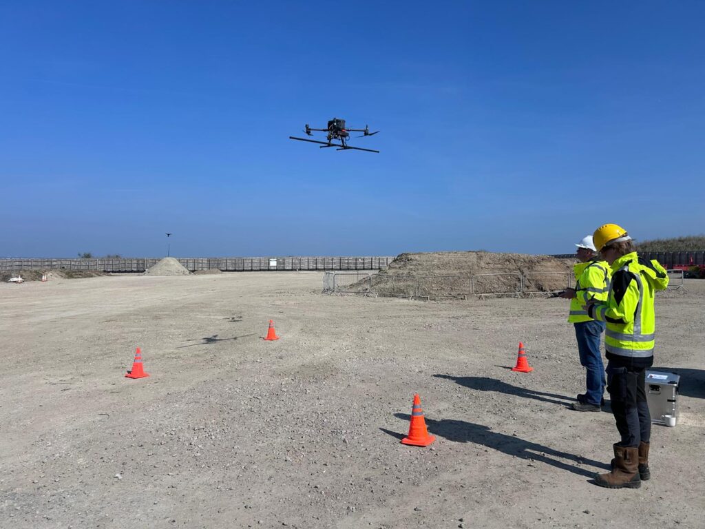
High-Precision Drone Surveys:
Next-level cable detection in hard-to-reach areas.
- Industry-first drone surveys for intertidal zones and mudflats
- Large-scale coverage via pre-programmed flight paths
- Collaborative operations with certified pilots, including beyond line-of-sight qualifications
- Future-ready technology, continually evolving for advanced capabilities
Safe, scalable, and precise. Our drones solutions make surveys in challenging environments faster and more efficient than ever.
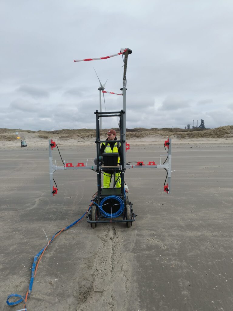
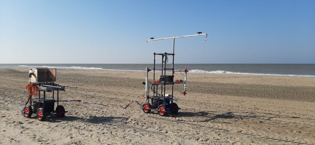
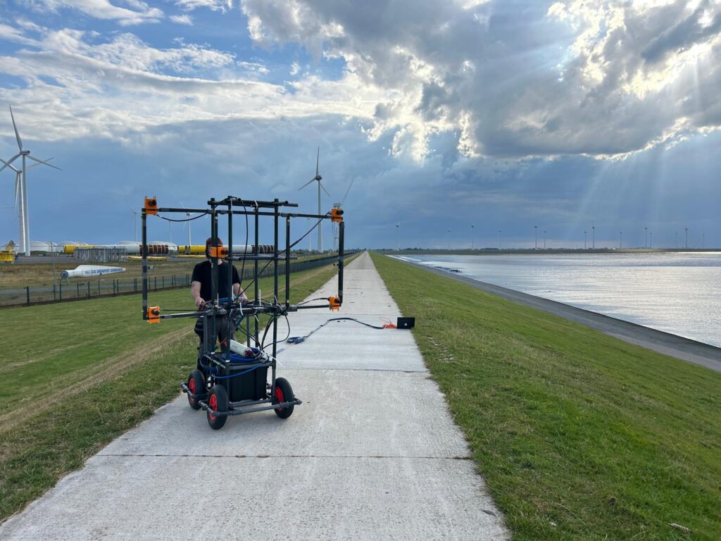
Versatile Onland Cart Surveys:
Reliable cable tracking from sea to shore.
- Ideal for landfall and shoreline zones to test magnetic field strength and detectability
- Works on beaches, dunes, and grassy terrain
- Lightweight, easy-to-deploy system with minimal integration
- Complements offshore surveys for continuous monitoring
Simple, effective, and dependable, our carts deliver fast results for landfall and shoreline cable surveys.
Custom Onshore Solutions:
Tailored detection systems for every project.
Bespoke systems for unique terrain or specialized survey requirements
Continuous development to improve detection methods
Collaborate with our experienced team to design the perfect solution
If you have a unique challenge, let’s start a conversation—our team will create a solution that fits your project perfectly.
High-Precision Drone Surveys:
Next-level cable detection in hard-to-reach areas.
- Industry-first drone surveys for intertidal zones and mudflats
- Large-scale coverage via pre-programmed flight paths
- Collaborative operations with certified pilots, including beyond line-of-sight qualifications
- Future-ready technology, continually evolving for advanced capabilities
Safe, scalable, and precise. Our drones solutions make surveys in challenging environments faster and more efficient than ever.
Versatile Onland Cart Surveys:
Reliable cable tracking from sea to shore.
- Ideal for landfall and shoreline zones to test magnetic field strength and detectability
- Works on beaches, dunes, and grassy terrain
- Lightweight, easy-to-deploy system with minimal integration
- Complements offshore surveys for continuous monitoring
Simple, effective, and dependable, our carts deliver fast results for landfall and shoreline cable surveys.
Custom Onshore Solutions:
Tailored detection systems for every project.
Bespoke systems for unique terrain or specialized survey requirements
Continuous development to improve detection methods
Collaborate with our experienced team to design the perfect solution
If you have a unique challenge, let’s start a conversation—our team will create a solution that fits your project perfectly.
High-Precision Drone Surveys:
Next-level cable detection in hard-to-reach areas.
- Industry-first drone surveys for intertidal zones and mudflats
- Large-scale coverage via pre-programmed flight paths
- Collaborative operations with certified pilots, including beyond line-of-sight qualifications
- Future-ready technology, continually evolving for advanced capabilities
Versatile Onland Cart Surveys:
Reliable cable tracking from sea to shore.
- Ideal for landfall and shoreline zones to test magnetic field strength and detectability
- Works on beaches, dunes, and grassy terrain
- Lightweight, easy-to-deploy system with minimal integration
- Complements offshore surveys for continuous monitoring
Simple, effective, and dependable, our carts deliver fast results for landfall and shoreline cable surveys.
Custom Onshore Solutions:
Tailored detection systems for every project.
Bespoke systems for unique terrain or specialized survey requirements
Continuous development to improve detection methods
Collaborate with our experienced team to design the perfect solution
If you have a unique challenge, let’s start a conversation—our team will create a solution that fits your project perfectly.